Last week I had a flat tire on my bicycle and had to walk home. This simple task was complicated by the layout of the suburban streets hereabouts. I could get to within 100 yards of my home, but could not reach it without crossing private homes and climbing backyard fences. The shortest alternate route was a two-hour walk, which I did.
It seems the local pols have had a policy of closing streets and erecting fences to limit motor vehicle traffic in residential areas. And it also prevents bicycle traffic and sometimes even foot traffic.
At the time, I asked my GPS to find me a quick route home, but the suggested route directed me to pass through a barricade at a closed intersection. This barricade even had a chain-link fence with a narrow right-left-right pedestrian chicane, to prevent folks from bringing bicycles through!
Here's the view from Tom-Tom:
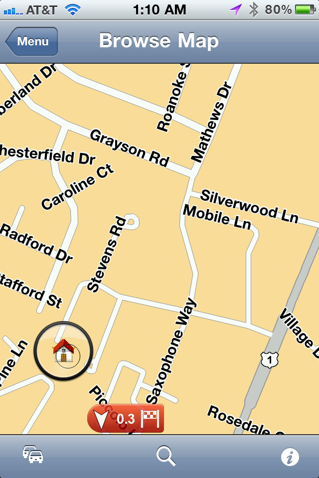 I was at the intersection of Mathews and Grayson and I wanted to get to the little "home" icon. But no, the road is closed, as shown on this view provided by Google Maps:
 Silverwood Lane is a blocked-off alley, with dozens of small trees growing there, and completely impassible.
Tom-Tom does allow users to make "corrections" to their maps and now when I call up the same intersection I see this:
 Here's a closer look:
 Silverwood Lane is still there, but Tom-Tom will no longer try to route me through this intersection.
Today I bicycled 2 miles to the local Starbucks for breakfast and I crossed over I-95. As I did I noticed that the northbound lanes were jammed but the southbound lanes were moving well:
 Facing south, with northbound traffic on the left and southbound traffic on the right. The two center lanes are the reversible HOV commuter lanes that drove Jay G so crazy when he was here a couple of weeks ago: "They go one way in the mawnin', and the other way in the awftahnoon! Those Vahginyuns ah wicked crazy!"
And here's the traffic view from Tom-Tom at the same spot:
 The orange arrows on white background indicate a traffic jam to be avoided. And only in the northbound lanes. My Blackberry using Garmin GPS could not differentiate between the lanes and simply reported the whole highway as jammed, even if traffic in one direction was moving normally.


1 comment:
Rand-McNally and a compass.
Only way to go.
Post a Comment